Geolocate

Habichtswald topographic map

Click on the map to display elevation.

About this map
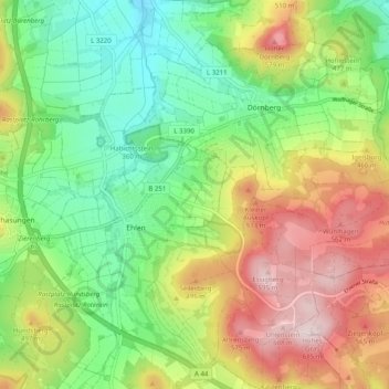
Name: Habichtswald topographic map, elevation, terrain.

Location: Habichtswald, Landkreis Kassel, Hessen, 34317, Duitsland (51.29736 9.28344 51.35982 9.38198)

Average elevation: 1,348 ft

Minimum elevation: 873 ft

Maximum elevation: 2,034 ft

Gear up for your next adventure:

💧Water Purification System - Clean water on the trail with reliable purifiers
🛡️Insect Repellent - Protection against bugs during outdoor activities
🪶Compact Camp Shovel - Folding shovel for campsite tasks
🔥Plasma Lighters - Windproof lighters that work in any weather condition
🧭Outdoor Navigation Book - Learn advanced navigation skills

As an Amazon Associate, this site earns from qualifying purchases at no extra cost to you.