Geolocate

Marden topographic map

Click on the map to display elevation.

About this map

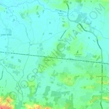
Name: Marden topographic map, elevation, terrain.

Location: Marden, Maidstone, Kent, England, United Kingdom (51.14135 0.45369 51.21231 0.54653)

Average elevation: 75 ft

Minimum elevation: 33 ft

Maximum elevation: 256 ft

Gear up for your next adventure:

🌡️Portable Weather Meter - Track weather conditions on the trail
📖Nature Tracking Books - Learn to track wildlife and terrain
Backpacking Tents - Weight-optimized shelters for multi-day topographic surveys
📻Weather Alert Radios - Stay informed of storm risks while off-the-grid
🪶Fire Starter Kit - Reliable fire starter for survival and camping

As an Amazon Associate, this site earns from qualifying purchases at no extra cost to you.