
Thank you for supporting this site ❤️
Make a donation
Make a donation
Gear up for your next adventure:
As an Amazon Associate, this site earns from qualifying purchases at no extra cost to you.
Longera topographic map
Click on the map to display elevation.
Thank you for supporting this site ❤️
Make a donation
Make a donation
Gear up for your next adventure:
As an Amazon Associate, this site earns from qualifying purchases at no extra cost to you.
About this map
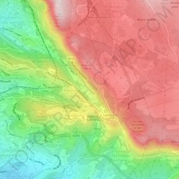
Name: Longera topographic map, elevation, terrain.
Location: Longera, Trieste, Friuli-Venezia Giulia, 34149, Italia (45.62003 13.81145 45.66003 13.85145)
Average elevation: 797 ft
Minimum elevation: 30 ft
Maximum elevation: 1,457 ft
Thank you for supporting this site ❤️
Make a donation
Make a donation
Gear up for your next adventure:
As an Amazon Associate, this site earns from qualifying purchases at no extra cost to you.