
Make a donation
Gear up for your next adventure:
As an Amazon Associate, this site earns from qualifying purchases at no extra cost to you.
Frielinghausen topographic map
Click on the map to display elevation.
Make a donation
Gear up for your next adventure:
As an Amazon Associate, this site earns from qualifying purchases at no extra cost to you.
Frielinghausen
Die Ortschaft liegt in einer Höhe von rund 310 m rund 1,5 km südlich von Bremke. Der Ortsteil mit 95 Einwohnern (Stand Juni 2023) und 40 Häusern befindet sich direkt an der Bundesstraße 511. Durch den Ort fließt die Wenne. An Frielinghausen grenzen die Ortschaften Dorlar, Bremke und Lochtrop. Die Wennebrücke in Frielinghausen wurde im Jahr 1910 erbaut.
Make a donation
Gear up for your next adventure:
As an Amazon Associate, this site earns from qualifying purchases at no extra cost to you.
About this map
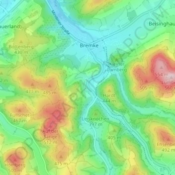
Name: Frielinghausen topographic map, elevation, terrain.
Average elevation: 1,247 ft
Minimum elevation: 951 ft
Maximum elevation: 1,827 ft
Make a donation
Gear up for your next adventure:
As an Amazon Associate, this site earns from qualifying purchases at no extra cost to you.