
Make a donation
Gear up for your next adventure:
As an Amazon Associate, this site earns from qualifying purchases at no extra cost to you.
Scenic State Park topographic map
Click on the map to display elevation.
Make a donation
Gear up for your next adventure:
As an Amazon Associate, this site earns from qualifying purchases at no extra cost to you.
About this map
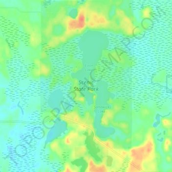
Name: Scenic State Park topographic map, elevation, terrain.
Location: Scenic State Park, Itasca County, Minnesota, United States (47.68846 -93.58718 47.74195 -93.54352)
Average elevation: 1,371 ft
Minimum elevation: 1,329 ft
Maximum elevation: 1,463 ft
Itasca County trails, hiking, mountain biking, running and outdoor activities
Make a donation
Gear up for your next adventure:
As an Amazon Associate, this site earns from qualifying purchases at no extra cost to you.
Other topographic maps
Click on a map to view its topography, its elevation and its terrain.
Wagon Wheel Mobile Home Park
United States > Minnesota > Itasca County > Grand Rapids
Average elevation: 1,345 ft
Make a donation
Gear up for your next adventure:
As an Amazon Associate, this site earns from qualifying purchases at no extra cost to you.