Geolocate

Sumucab topographic map

Click on the map to display elevation.

About this map

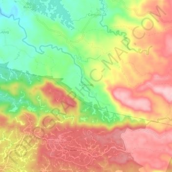
Name: Sumucab topographic map, elevation, terrain.

Location: Sumucab, Cavinti, Laguna, Calabarzon, 4013, Philippines (14.19995 121.54867 14.22692 121.60660)

Average elevation: 1,224 ft

Minimum elevation: 860 ft

Maximum elevation: 1,519 ft

Other topographic maps

Click on a map to view its topography, its elevation and its terrain.

Cavinti

Philippines > Laguna > Cavinti

Average elevation: 820 ft

Silangan Talaongan

Philippines > Laguna > Cavinti

Average elevation: 945 ft

Sumucab

Philippines > Laguna > Cavinti

Average elevation: 1,214 ft

Layasin

Philippines > Laguna > Cavinti

Average elevation: 830 ft

Pagsanjan Falls

Philippines > Laguna > Cavinti

Average elevation: 702 ft

Gear up for your next adventure:

📶Vehicle Signal Boosters - Improve reception in rural areas while driving to trailheads
⛑️Personal Locator Beacon - Safety beacon for emergencies
📶Satellite Messenger - Communication device off‑grid
🔊Portable Camp Speaker - Music and alerts at camp
🧭Outdoor Navigation Book - Learn advanced navigation skills

As an Amazon Associate, this site earns from qualifying purchases at no extra cost to you.