
Make a donation
Gear up for your next adventure:
As an Amazon Associate, this site earns from qualifying purchases at no extra cost to you.
Wilden topographic map
Click on the map to display elevation.
Make a donation
Gear up for your next adventure:
As an Amazon Associate, this site earns from qualifying purchases at no extra cost to you.
Wilden
Der Ort hat eine Gemarkungsfläche von 7,21 km² und liegt, bedingt durch seine Länge auf einer Höhe zwischen 300 m über NN beim Ortsausgang in Richtung Salchendorf und 370 m über NN beim Ortsausgang Oberwilden in Richtung Wilnsdorf.
Make a donation
Gear up for your next adventure:
As an Amazon Associate, this site earns from qualifying purchases at no extra cost to you.
About this map
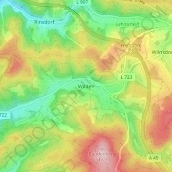
Name: Wilden topographic map, elevation, terrain.
Average elevation: 1,260 ft
Minimum elevation: 919 ft
Maximum elevation: 1,680 ft
Make a donation
Gear up for your next adventure:
As an Amazon Associate, this site earns from qualifying purchases at no extra cost to you.