
Paint Lake Provincial Park topographic map
Interactive map
Click on the map to display elevation.
About this map
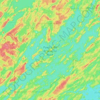
Name: Paint Lake Provincial Park topographic map, elevation, terrain.
Average elevation: 650 ft
Minimum elevation: 587 ft
Maximum elevation: 784 ft
Other topographic maps
Click on a map to view its topography, its elevation and its terrain.
Halfway Lake
Canada > Manitoba > Local Government District of Mystery Lake
Halfway Lake, Local Government District of Mystery Lake, Manitoba, Canada
Average elevation: 738 ft
Setting Lake
Canada > Manitoba > Local Government District of Mystery Lake
Setting Lake, Local Government District of Mystery Lake, Manitoba, Canada
Average elevation: 751 ft