
Make a donation
Gear up for your next adventure:
As an Amazon Associate, this site earns from qualifying purchases at no extra cost to you.
Frauenstein topographic map
Click on the map to display elevation.
Make a donation
Gear up for your next adventure:
As an Amazon Associate, this site earns from qualifying purchases at no extra cost to you.
Frauenstein
Um Frauenstein gibt es, neben Wein, zahlreiche Kirschbaum-Wiesen, die vor allem zur Kirschblüte im Frühjahr ein beliebtes Ausflugsziel sind. Hinter diesen Obstwiesen führen Wanderwege zum Grauen Stein (339 m) bei Georgenborn im Nonnenbuchwald. Mit einer Höhe von 25 m gehört der Graue Stein zu einem Quarzitgang, der vor rund 320 Millionen Jahren entstand und ca. 4 km weit bis zum Spitzen Stein reicht. Der Graue Stein wird auch als Kletter-Übungsfels genutzt.
Make a donation
Gear up for your next adventure:
As an Amazon Associate, this site earns from qualifying purchases at no extra cost to you.
About this map
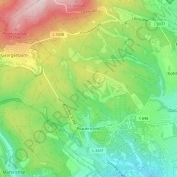
Name: Frauenstein topographic map, elevation, terrain.
Location: Frauenstein, Wiesbaden, Hessen, Deutschland (50.05182 8.11067 50.10337 8.18067)
Average elevation: 896 ft
Minimum elevation: 331 ft
Maximum elevation: 1,857 ft
Make a donation
Gear up for your next adventure:
As an Amazon Associate, this site earns from qualifying purchases at no extra cost to you.
Other topographic maps
Click on a map to view its topography, its elevation and its terrain.
Neroberg
Deutschland > Hessen > Wiesbaden
Im Wald hinter der Erlebnismulde gibt es seit dem Juni 2006 den Kletterwald Neroberg. Der Hochseilgarten mit etwa 80 Kletterelementen wurde in den Baumbestand integriert. Der Kletterwald Neroberg besteht aus mehreren Parcours in verschiedenen Höhen und mit unterschiedlichem Schwierigkeitsgrad.
Average elevation: 682 ft
Make a donation
Gear up for your next adventure:
As an Amazon Associate, this site earns from qualifying purchases at no extra cost to you.