
Thank you for supporting this site ❤️
Make a donation
Make a donation
Gear up for your next adventure:
As an Amazon Associate, this site earns from qualifying purchases at no extra cost to you.
Mardan topographic map
Click on the map to display elevation.
Thank you for supporting this site ❤️
Make a donation
Make a donation
Gear up for your next adventure:
As an Amazon Associate, this site earns from qualifying purchases at no extra cost to you.
About this map
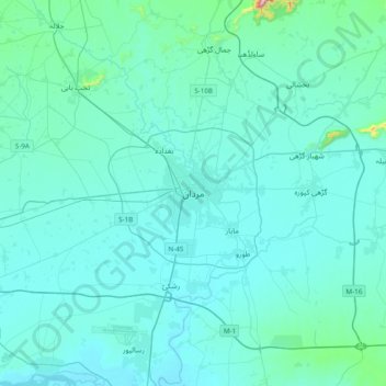
Name: Mardan topographic map, elevation, terrain.
Location: Mardan, Swabi, Khyber Pakhtunkhwa, 23200, Pakistan (34.03380 71.88515 34.35380 72.20515)
Average elevation: 1,076 ft
Minimum elevation: 932 ft
Maximum elevation: 2,933 ft
Thank you for supporting this site ❤️
Make a donation
Make a donation
Gear up for your next adventure:
As an Amazon Associate, this site earns from qualifying purchases at no extra cost to you.