
Thank you for supporting this site ❤️
Make a donation
Make a donation
Gear up for your next adventure:
As an Amazon Associate, this site earns from qualifying purchases at no extra cost to you.
Huasquilla topographic map
Click on the map to display elevation.
Thank you for supporting this site ❤️
Make a donation
Make a donation
Gear up for your next adventure:
As an Amazon Associate, this site earns from qualifying purchases at no extra cost to you.
About this map
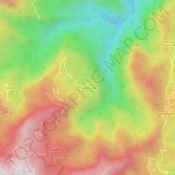
Name: Huasquilla topographic map, elevation, terrain.
Location: Huasquilla, San Bartolo Tutotepec, Hidalgo, México (20.42639 -98.24222 20.46639 -98.20222)
Average elevation: 4,137 ft
Minimum elevation: 2,133 ft
Maximum elevation: 6,056 ft
Thank you for supporting this site ❤️
Make a donation
Make a donation
Gear up for your next adventure:
As an Amazon Associate, this site earns from qualifying purchases at no extra cost to you.