Geolocate

Hurricane topographic map

Click on the map to display elevation.

About this map

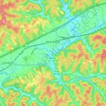
Name: Hurricane topographic map, elevation, terrain.

Location: Hurricane, Putnam County, West Virginia, United States (38.39422 -82.05144 38.45741 -81.97254)

Average elevation: 778 ft

Minimum elevation: 604 ft

Maximum elevation: 1,063 ft

Putnam County trails, hiking, mountain biking, running and outdoor activities

Other topographic maps

Click on a map to view its topography, its elevation and its terrain.

Liberty

United States > West Virginia > Putnam County

Average elevation: 922 ft

Gear up for your next adventure:

📱Solar Portable Charger - Solar power bank for charging devices off‑grid
🪶Thermal Camp Blanket - Extra warmth for cold nights
👟Trail Running Shoes - Lightweight shoes for trail runners
🔥Fast-Boil Camping Stoves - Efficient cooking systems for quick trail meals
🦺Reflective Outdoor Gear - Safety gear for low‑light conditions

As an Amazon Associate, this site earns from qualifying purchases at no extra cost to you.