
Thank you for supporting this site ❤️
Make a donation
Make a donation
Gear up for your next adventure:
As an Amazon Associate, this site earns from qualifying purchases at no extra cost to you.
Ferriera topographic map
Click on the map to display elevation.
Thank you for supporting this site ❤️
Make a donation
Make a donation
Gear up for your next adventure:
As an Amazon Associate, this site earns from qualifying purchases at no extra cost to you.
About this map
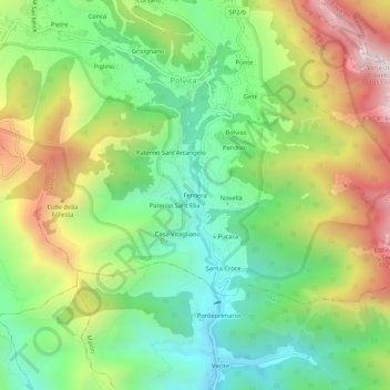
Name: Ferriera topographic map, elevation, terrain.
Location: Ferriera, Polvica, Tramonti, Salerno, Campania, 84019, Italia (40.66246 14.62146 40.70246 14.66146)
Average elevation: 1,401 ft
Minimum elevation: 151 ft
Maximum elevation: 3,350 ft
Thank you for supporting this site ❤️
Make a donation
Make a donation
Gear up for your next adventure:
As an Amazon Associate, this site earns from qualifying purchases at no extra cost to you.