
Thank you for supporting this site ❤️
Make a donation
Make a donation
Gear up for your next adventure:
As an Amazon Associate, this site earns from qualifying purchases at no extra cost to you.
Oicatá topographic map
Click on the map to display elevation.
Thank you for supporting this site ❤️
Make a donation
Make a donation
Gear up for your next adventure:
As an Amazon Associate, this site earns from qualifying purchases at no extra cost to you.
About this map
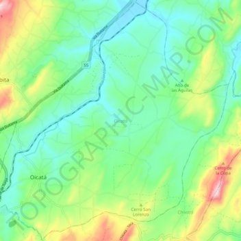
Name: Oicatá topographic map, elevation, terrain.
Location: Oicatá, Centro, Boyacá, Colombia (5.56916 -73.32872 5.66491 -73.23125)
Average elevation: 8,907 ft
Minimum elevation: 8,474 ft
Maximum elevation: 9,951 ft
Thank you for supporting this site ❤️
Make a donation
Make a donation
Gear up for your next adventure:
As an Amazon Associate, this site earns from qualifying purchases at no extra cost to you.