
Thank you for supporting this site ❤️
Make a donation
Make a donation
Gear up for your next adventure:
As an Amazon Associate, this site earns from qualifying purchases at no extra cost to you.
Mansehra topographic map
Click on the map to display elevation.
Thank you for supporting this site ❤️
Make a donation
Make a donation
Gear up for your next adventure:
As an Amazon Associate, this site earns from qualifying purchases at no extra cost to you.
About this map
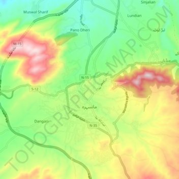
Name: Mansehra topographic map, elevation, terrain.
Location: Mansehra, Khyber Pakhtunkhwa, Pakistan (34.29815 73.16883 34.37324 73.23579)
Average elevation: 3,579 ft
Minimum elevation: 2,881 ft
Maximum elevation: 4,600 ft
Thank you for supporting this site ❤️
Make a donation
Make a donation
Gear up for your next adventure:
As an Amazon Associate, this site earns from qualifying purchases at no extra cost to you.