
Thank you for supporting this site ❤️
Make a donation
Make a donation
Gear up for your next adventure:
As an Amazon Associate, this site earns from qualifying purchases at no extra cost to you.
Yupash topographic map
Click on the map to display elevation.
Thank you for supporting this site ❤️
Make a donation
Make a donation
Gear up for your next adventure:
As an Amazon Associate, this site earns from qualifying purchases at no extra cost to you.
About this map
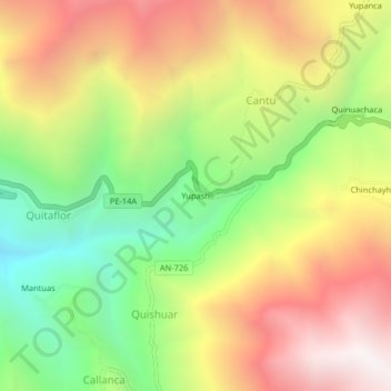
Name: Yupash topographic map, elevation, terrain.
Location: Yupash, Cantu, Pira, Huaraz, Áncash, Perú (-9.57941 -77.70883 -9.53941 -77.66883)
Average elevation: 12,198 ft
Minimum elevation: 9,646 ft
Maximum elevation: 14,879 ft
Thank you for supporting this site ❤️
Make a donation
Make a donation
Gear up for your next adventure:
As an Amazon Associate, this site earns from qualifying purchases at no extra cost to you.