
Thank you for supporting this site ❤️
Make a donation
Make a donation
Gear up for your next adventure:
As an Amazon Associate, this site earns from qualifying purchases at no extra cost to you.
Pinegrove topographic map
Click on the map to display elevation.
Thank you for supporting this site ❤️
Make a donation
Make a donation
Gear up for your next adventure:
As an Amazon Associate, this site earns from qualifying purchases at no extra cost to you.
About this map
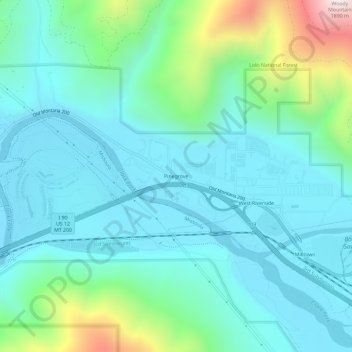
Name: Pinegrove topographic map, elevation, terrain.
Location: Pinegrove, Missoula County, Montana, 59851, United States (46.86020 -113.92316 46.90020 -113.88316)
Average elevation: 3,789 ft
Minimum elevation: 3,192 ft
Maximum elevation: 6,171 ft
Thank you for supporting this site ❤️
Make a donation
Make a donation
Gear up for your next adventure:
As an Amazon Associate, this site earns from qualifying purchases at no extra cost to you.