Geolocate

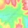
Young topographic map

Click on the map to display elevation.

About this map
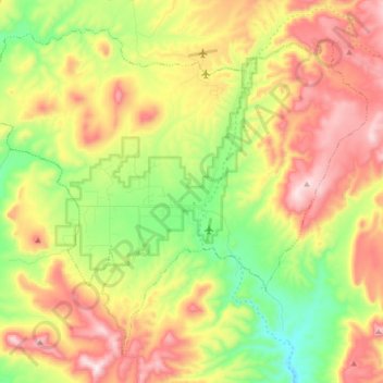
Name: Young topographic map, elevation, terrain.

Location: Young, Gila County, Arizona, 85554, United States (34.04675 -111.03271 34.16658 -110.86216)

Average elevation: 5,525 ft

Minimum elevation: 4,685 ft

Maximum elevation: 6,499 ft

Gila County trails, hiking, mountain biking, running and outdoor activities

Other topographic maps

Click on a map to view its topography, its elevation and its terrain.
Peridot

United States > Arizona > Gila County > Peridot

Average elevation: 2,690 ft

Strawberry

United States > Arizona > Gila County

Average elevation: 6,198 ft

Hunter Creek

United States > Arizona > Gila County

Average elevation: 6,115 ft

Rancho Del Escondido

United States > Arizona > Gila County

Average elevation: 2,398 ft

Greenback Peak

United States > Arizona > Gila County

Average elevation: 5,512 ft

Beaver Valley Estates

United States > Arizona > Gila County

Average elevation: 5,131 ft

Roosevelt

United States > Arizona > Gila County

Average elevation: 2,405 ft

Fort McDonald

United States > Arizona > Gila County > Payson

Average elevation: 4,970 ft

Copper Hill

United States > Arizona > Gila County

Average elevation: 4,091 ft

Blackjack Mountains

United States > Arizona > Gila County

Average elevation: 3,963 ft

Hunter Creek

United States > Arizona > Gila County

Average elevation: 6,115 ft

White Mountain

United States > Arizona > Gila County

Average elevation: 4,472 ft

Carol Spring

United States > Arizona > Gila County

Average elevation: 5,866 ft

Rock Island

United States > Arizona > Gila County

Average elevation: 2,110 ft

Star Valley

United States > Arizona > Gila County > Star Valley

According to the United States Census Bureau, the town has a total area of 36.1 square miles (93.6 km2), of which 0.01 square miles (0.02 km2), or 0.03%, is water. Star Valley sits at an elevation of 4,650 feet (1,420 m) and takes its name from the valley in which it is located, formed by Houston Creek, which…

Average elevation: 4,990 ft
Beaver Valley Estates

United States > Arizona > Gila County

Average elevation: 5,131 ft

Miami

United States > Arizona > Gila County

Average elevation: 3,678 ft

Bull Canyon

United States > Arizona > Gila County

Average elevation: 3,904 ft

White Tank

United States > Arizona > Gila County

Average elevation: 4,259 ft

Cedar Mesa

United States > Arizona > Gila County

Average elevation: 5,374 ft

Gear up for your next adventure:

🧯Emergency Survival Kit - All‑in‑one survival essentials for the backcountry
📷Action Cameras - Rugged cameras to document your journeys across rugged terrain
🪶LED Camping Lantern - Bright lantern for camp lighting
🎒Day Hiking Backpack - Lightweight backpack perfect for day trips and outdoor adventures
🦶Carbon Trekking Poles - Reduce knee impact on steep descents with ultra-light poles

As an Amazon Associate, this site earns from qualifying purchases at no extra cost to you.