
Гыда topographic map
Interactive map
Click on the map to display elevation.
About this map
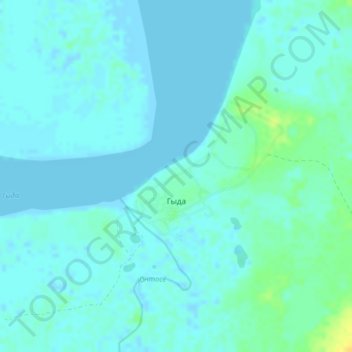
Name: Гыда topographic map, elevation, terrain.
Average elevation: 13 ft
Minimum elevation: -13 ft
Maximum elevation: 69 ft
Other topographic maps
Click on a map to view its topography, its elevation and its terrain.
Tazovsky
Russia > Yamalo-Nenets Autonomous Okrug > Tazovsky Rayon
Tazovsky, Tazovsky Rayon, Yamalo-Nenets Autonomous Okrug, Ural Federal District, 629350, Russia
Average elevation: 46 ft