Geolocate

Giglio topographic map

Click on the map to display elevation.

About this map

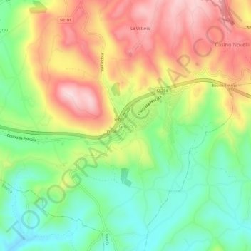
Name: Giglio topographic map, elevation, terrain.

Location: Giglio, Veroli, Frosinone, Lazio, 03029, Italy (41.64261 13.40660 41.68261 13.44660)

Average elevation: 1,007 ft

Minimum elevation: 561 ft

Maximum elevation: 1,552 ft

Gear up for your next adventure:

🥄Camping Utensil Set - Lightweight utensils for outdoor meals
📷Action Cameras - Rugged cameras to document your journeys across rugged terrain
🛰️Satellite Messengers - Emergency SOS and two-way messaging for off-grid adventures
📚Navigation Handbooks - Master the art of reading topographic maps and using a compass
🔥Camping Stove - Portable stove for camping and backcountry cooking

As an Amazon Associate, this site earns from qualifying purchases at no extra cost to you.