
Thank you for supporting this site ❤️
Make a donation
Make a donation
Gear up for your next adventure:
As an Amazon Associate, this site earns from qualifying purchases at no extra cost to you.
Sangrun topographic map
Click on the map to display elevation.
Thank you for supporting this site ❤️
Make a donation
Make a donation
Gear up for your next adventure:
As an Amazon Associate, this site earns from qualifying purchases at no extra cost to you.
About this map
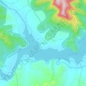
Name: Sangrun topographic map, elevation, terrain.
Location: Sangrun, Haveli, Pune, Maharashtra, India (18.37961 73.65681 18.41961 73.69681)
Average elevation: 2,100 ft
Minimum elevation: 1,877 ft
Maximum elevation: 3,081 ft
Thank you for supporting this site ❤️
Make a donation
Make a donation
Gear up for your next adventure:
As an Amazon Associate, this site earns from qualifying purchases at no extra cost to you.