Geolocate

Consell topographic map

Click on the map to display elevation.

About this map

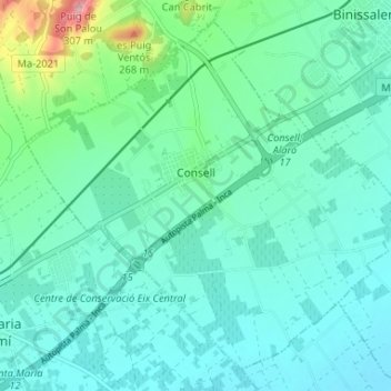
Name: Consell topographic map, elevation, terrain.

Location: Consell, Raiguer, Balearic Islands, 07330, Spain (39.64312 2.78504 39.68805 2.85043)

Average elevation: 463 ft

Minimum elevation: 348 ft

Maximum elevation: 984 ft

Other topographic maps

Click on a map to view its topography, its elevation and its terrain.

Gear up for your next adventure:

🔪Outdoor Multitools - Essential survival tools for gear repair and field use
🦺Reflective Outdoor Gear - Safety gear for low‑light conditions
🪄Magnetic Compass - Accurate compass for navigation
🩹Survival Bandages - High‑quality bandages for emergencies
🌡️Portable Weather Meter - Track weather conditions on the trail

As an Amazon Associate, this site earns from qualifying purchases at no extra cost to you.