
Thank you for supporting this site ❤️
Make a donation
Make a donation
Gear up for your next adventure:
As an Amazon Associate, this site earns from qualifying purchases at no extra cost to you.
Farur topographic map
Click on the map to display elevation.
Thank you for supporting this site ❤️
Make a donation
Make a donation
Gear up for your next adventure:
As an Amazon Associate, this site earns from qualifying purchases at no extra cost to you.
About this map
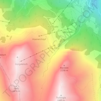
Name: Farur topographic map, elevation, terrain.
Location: Farur, Tschiertschen-Praden, Plessur, Grisons, 7064, Switzerland (46.78902 9.58554 46.80902 9.60554)
Average elevation: 6,447 ft
Minimum elevation: 4,295 ft
Maximum elevation: 8,002 ft
Thank you for supporting this site ❤️
Make a donation
Make a donation
Gear up for your next adventure:
As an Amazon Associate, this site earns from qualifying purchases at no extra cost to you.