
Thank you for supporting this site ❤️
Make a donation
Make a donation
Gear up for your next adventure:
As an Amazon Associate, this site earns from qualifying purchases at no extra cost to you.
Thibar topographic map
Click on the map to display elevation.
Thank you for supporting this site ❤️
Make a donation
Make a donation
Gear up for your next adventure:
As an Amazon Associate, this site earns from qualifying purchases at no extra cost to you.
About this map
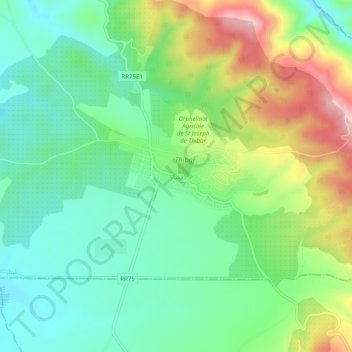
Name: Thibar topographic map, elevation, terrain.
Location: Thibar, Tibar, Délégation Tibar, Gouvernorat Béja, 9022, Tunisie (36.50182 9.08498 36.54182 9.12498)
Average elevation: 1,148 ft
Minimum elevation: 860 ft
Maximum elevation: 1,706 ft
Thank you for supporting this site ❤️
Make a donation
Make a donation
Gear up for your next adventure:
As an Amazon Associate, this site earns from qualifying purchases at no extra cost to you.