Geolocate

Meeswijk topographic map

Click on the map to display elevation.

Meeswijk

Meeswijk ligt in de vallei van de Maas, op een hoogte van 35 à 38 meter. In 2021 waren ingrijpende herstellingen nodig aan de weg naar het veer na de hoogwaterstanden van de Maas in juli 2021.

Wikipedia (CC-BY-SA 3.0)

About this map

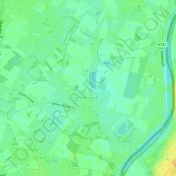
Name: Meeswijk topographic map, elevation, terrain.

Location: Meeswijk, Maasmechelen, Tongeren, Limburg, Vlaanderen, België (50.99330 5.72767 51.01227 5.76767)

Average elevation: 115 ft

Minimum elevation: 82 ft

Maximum elevation: 164 ft

Other topographic maps

Click on a map to view its topography, its elevation and its terrain.

Proosterbos

België > Limburg > Tongeren > Maasmechelen

Average elevation: 154 ft

Mechelse Heide

België > Limburg > Tongeren > Maasmechelen

Average elevation: 210 ft

Rode Terril

België > Limburg > Tongeren > Maasmechelen

Average elevation: 187 ft

Daalgrimbie

België > Limburg > Tongeren > Maasmechelen > Opgrimbie > Daalgrimbie

Average elevation: 144 ft

Gear up for your next adventure:

🔋Solar Power Banks - Keep your GPS and phone charged in remote wilderness areas
🧢Sun Protection Hats - Wide-brimmed and UPF-rated hats for high-altitude sun safety
🧭Outdoor Navigation Book - Learn advanced navigation skills
🔭Stargazing Telescopes - Perfect for camping in low-light pollution areas shown on maps
🧥Men's Rain Shells - Premium waterproof and breathable jackets for mountain weather

As an Amazon Associate, this site earns from qualifying purchases at no extra cost to you.