
Thank you for supporting this site ❤️
Make a donation
Make a donation
Gear up for your next adventure:
As an Amazon Associate, this site earns from qualifying purchases at no extra cost to you.
pirsal topographic map
Click on the map to display elevation.
Thank you for supporting this site ❤️
Make a donation
Make a donation
Gear up for your next adventure:
As an Amazon Associate, this site earns from qualifying purchases at no extra cost to you.
About this map
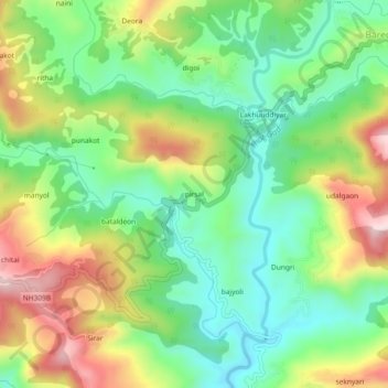
Name: pirsal topographic map, elevation, terrain.
Location: pirsal, Almora, Uttarakhand, 263600, India (29.60605 79.70373 29.64605 79.74373)
Average elevation: 4,636 ft
Minimum elevation: 4,147 ft
Maximum elevation: 5,407 ft
Thank you for supporting this site ❤️
Make a donation
Make a donation
Gear up for your next adventure:
As an Amazon Associate, this site earns from qualifying purchases at no extra cost to you.