Geolocate

Saba topographic map

Click on the map to display elevation.

About this map

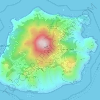
Name: Saba topographic map, elevation, terrain.

Location: Saba, The Bottom, Saba, Netherlands (17.61426 -63.25846 17.65038 -63.21478)

Average elevation: 545 ft

Minimum elevation: -3 ft

Maximum elevation: 2,779 ft

Gear up for your next adventure:

🔥Camping Stove - Portable stove for camping and backcountry cooking
🪶Trail Camera - Capture wildlife on your hikes
⛑️Personal Locator Beacon - Safety beacon for emergencies
🧭Compass with Lanyard - Easy‑carry compass for navigation
🕶️Glacier Sunglasses - Side shields to protect eyes from high-altitude snow glare

As an Amazon Associate, this site earns from qualifying purchases at no extra cost to you.