
Abdimandi topographic map
Click on the map to display elevation.
About this map
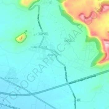
Name: Abdimandi topographic map, elevation, terrain.
Location: Abdimandi, Chhatrapati Sambhajinagar, Maharashtra, India (19.91628 75.20568 19.95628 75.24568)
Average elevation: 2,057 ft
Minimum elevation: 1,860 ft
Maximum elevation: 2,858 ft
Other topographic maps
Click on a map to view its topography, its elevation and its terrain.
Daulatabad Fort
India > Maharashtra > Chhatrapati Sambhajinagar > Daulatabad
Average elevation: 1,985 ft