Geolocate

Valdivelo topographic map

Click on the map to display elevation.

About this map

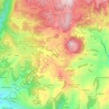
Name: Valdivelo topographic map, elevation, terrain.

Location: Valdivelo, Velo Veronese, Verona, Veneto, 37028, Italia (45.58950 11.07010 45.62950 11.11010)

Average elevation: 3,360 ft

Minimum elevation: 2,461 ft

Maximum elevation: 4,124 ft

Gear up for your next adventure:

🥤Water Filter Bottle - All‑in‑one filter bottle for safe hydration
🏕️Family Camping Gear - Essentials for group camping trips
Backpacking Tent - Lightweight and durable tent for multi‑day hikes
🥘Titanium Cookware - Durable, featherlight pots and pans for backpacking
🪑Ultralight Camp Chairs - Portable seating for resting after a long day of mapping

As an Amazon Associate, this site earns from qualifying purchases at no extra cost to you.