Geolocate

Castleblayney topographic map

Click on the map to display elevation.

Castleblayney

A few miles to the north-east is the highest elevation in County Monaghan, 'Mullyash', at altitude 317 m (1,034 ft).

Wikipedia (CC-BY-SA 3.0)

About this map

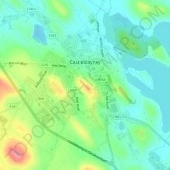
Name: Castleblayney topographic map, elevation, terrain.

Location: Castleblayney, Carrickmacross-Castleblaney Municipal District, County Monaghan, Ulster, Ireland (54.10485 -6.75684 54.12804 -6.71769)

Average elevation: 374 ft

Minimum elevation: 269 ft

Maximum elevation: 614 ft

Other topographic maps

Click on a map to view its topography, its elevation and its terrain.

Lough Egish

Ireland > County Monaghan

Average elevation: 518 ft

Magheracloone

Ireland > County Monaghan

Average elevation: 187 ft

Annayalla

Ireland > County Monaghan

Average elevation: 404 ft

Lough Fea

Ireland > County Monaghan

Average elevation: 164 ft

Tydavnet

Ireland > County Monaghan

Average elevation: 289 ft

Newbliss

Ireland > County Monaghan > Newbliss

Average elevation: 377 ft

Drumass Round Tower

Ireland > County Monaghan > Inishkeen

Average elevation: 194 ft

Ballybay Town Park

Ireland > County Monaghan

Average elevation: 308 ft

Gear up for your next adventure:

🎒Outdoor Daypacks - Lightweight backpacks designed for carrying maps and essential gear
🧭Pro Hiking Compasses - High-accuracy liquid-filled compasses for topographic orientation
🔦Compact Flashlight - Reliable flashlight for emergencies
🧼Biodegradable Camping Soap - Eco‑friendly soap for outdoor hygiene
🪶Trail Camera - Capture wildlife on your hikes

As an Amazon Associate, this site earns from qualifying purchases at no extra cost to you.