
Make a donation
Gear up for your next adventure:
As an Amazon Associate, this site earns from qualifying purchases at no extra cost to you.
Selfkant topographic map
Click on the map to display elevation.
Make a donation
Gear up for your next adventure:
As an Amazon Associate, this site earns from qualifying purchases at no extra cost to you.
About this map
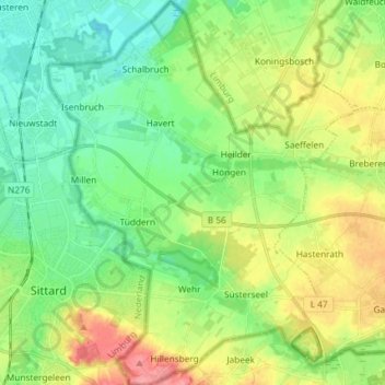
Name: Selfkant topographic map, elevation, terrain.
Location: Selfkant, Kreis Heinsberg, North Rhine-Westphalia, Germany (50.97455 5.86632 51.06688 5.98351)
Average elevation: 180 ft
Minimum elevation: 89 ft
Maximum elevation: 341 ft
Make a donation
Gear up for your next adventure:
As an Amazon Associate, this site earns from qualifying purchases at no extra cost to you.
Other topographic maps
Click on a map to view its topography, its elevation and its terrain.
Kleingladbach
Germany > North Rhine-Westphalia > Kreis Heinsberg > Hückelhoven
Average elevation: 276 ft
Wahnenbusch
Germany > North Rhine-Westphalia > Kreis Heinsberg > Erkelenz > Tenholt
Average elevation: 308 ft
Watern
Germany > North Rhine-Westphalia > Kreis Heinsberg > Wegberg > Klinkum
Average elevation: 253 ft
Make a donation
Gear up for your next adventure:
As an Amazon Associate, this site earns from qualifying purchases at no extra cost to you.
Auf dem Wengel
Germany > North Rhine-Westphalia > Kreis Heinsberg > Wegberg > Büch
Average elevation: 259 ft
Make a donation
Gear up for your next adventure:
As an Amazon Associate, this site earns from qualifying purchases at no extra cost to you.
Rödgen
Germany > North Rhine-Westphalia > Kreis Heinsberg > Wegberg > Rödgen
Average elevation: 249 ft
Hückelhoven
Germany > North Rhine-Westphalia > Kreis Heinsberg > Hückelhoven > Hückelhoven
Average elevation: 226 ft
Make a donation
Gear up for your next adventure:
As an Amazon Associate, this site earns from qualifying purchases at no extra cost to you.