Geolocate

Rogaro topographic map

Click on the map to display elevation.

About this map

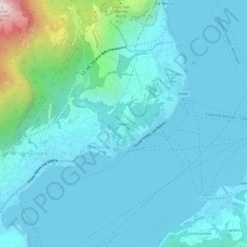
Name: Rogaro topographic map, elevation, terrain.

Location: Rogaro, Tremezzo, Tremezzina, Como, Lombardia, 22016, Italia (45.96722 9.20429 46.00722 9.24429)

Average elevation: 1,201 ft

Minimum elevation: 604 ft

Maximum elevation: 5,351 ft

Gear up for your next adventure:

🏔️Mountain Trail Maps - High‑detail maps for popular peaks
🔦Compact Flashlight - Reliable flashlight for emergencies
🥾Women's Hiking Boots - Top-rated trail boots with ankle support and superior grip
🌡️Portable Weather Meter - Track weather conditions on the trail
📱Heavy-Duty Phone Cases - Drop-proof and waterproof protection for outdoor navigation

As an Amazon Associate, this site earns from qualifying purchases at no extra cost to you.