
Rochester topographic map
Click on the map to display elevation.
About this map
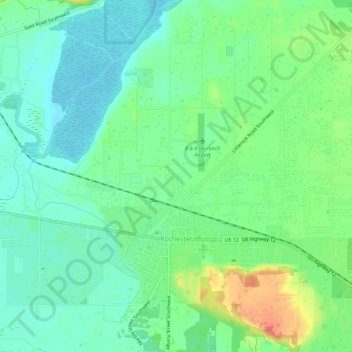
Name: Rochester topographic map, elevation, terrain.
Location: Rochester, Thurston County, Washington, United States (46.82092 -123.09711 46.83665 -123.03997)
Average elevation: 138 ft
Minimum elevation: 72 ft
Maximum elevation: 282 ft
Other topographic maps
Click on a map to view its topography, its elevation and its terrain.
Centralia Coal Mine Dam No 32B
United States > Washington > Thurston County > Tono
Average elevation: 341 ft