Geolocate

Kaddakiro topographic map

Click on the map to display elevation.

About this map

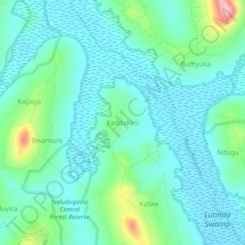
Name: Kaddakiro topographic map, elevation, terrain.

Location: Kaddakiro, Mpigi, Central Region, Uganda (0.18966 32.24313 0.22966 32.28313)

Average elevation: 3,865 ft

Minimum elevation: 3,753 ft

Maximum elevation: 4,285 ft

Gear up for your next adventure:

🎒Waterproof Dry Bags - Keep your electronics and maps dry inside your pack
🔥Fast-Boil Camping Stoves - Efficient cooking systems for quick trail meals
🛡️Insect Repellent - Protection against bugs during outdoor activities
⛑️Personal Locator Beacon - Safety beacon for emergencies
🦟Ultrasonic Repellers - Create a bug-free zone at your camp or rest stop

As an Amazon Associate, this site earns from qualifying purchases at no extra cost to you.