Geolocate

Teslin topographic map

Click on the map to display elevation.

About this map

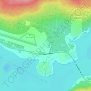
Name: Teslin topographic map, elevation, terrain.

Location: Teslin, Yukon, Y0A 1B0, Canada (60.16152 -132.72829 60.18025 -132.69143)

Average elevation: 2,300 ft

Minimum elevation: 2,198 ft

Maximum elevation: 2,572 ft

Gear up for your next adventure:

🛡️Bear Spray Outdoor - Protection in bear country hikes
🏕️Family Camping Gear - Essentials for group camping trips
📖Nature Tracking Books - Learn to track wildlife and terrain
🪶Fire Starter Kit - Reliable fire starter for survival and camping
🚗GPS Dash Cams - Record your scenic drives through mountain passes and canyons

As an Amazon Associate, this site earns from qualifying purchases at no extra cost to you.