
New London topographic map
Click on the map to display elevation.
About this map
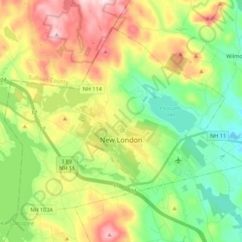
Name: New London topographic map, elevation, terrain.
Location: New London, Merrimack County, New Hampshire, United States (43.38012 -72.05798 43.46492 -71.90704)
Average elevation: 1,198 ft
Minimum elevation: 699 ft
Maximum elevation: 1,982 ft
Merrimack County trails, hiking, mountain biking, running and outdoor activities
Other topographic maps
Click on a map to view its topography, its elevation and its terrain.
Catamount Mountain
United States > New Hampshire > Merrimack County > Pittsfield
Average elevation: 922 ft
Kezer Seminary
United States > New Hampshire > Merrimack County > Canterbury
Average elevation: 633 ft
Shaker Village
United States > New Hampshire > Merrimack County > Canterbury
Average elevation: 673 ft
Rings Corner
United States > New Hampshire > Merrimack County > Pittsfield > Rings Corner
Average elevation: 623 ft