
Suncook topographic map
Click on the map to display elevation.
About this map
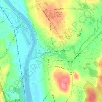
Name: Suncook topographic map, elevation, terrain.
Average elevation: 305 ft
Minimum elevation: 174 ft
Maximum elevation: 509 ft
Merrimack County trails, hiking, mountain biking, running and outdoor activities
Other topographic maps
Click on a map to view its topography, its elevation and its terrain.
Boscawen
United States > New Hampshire > Merrimack County
According to the United States Census Bureau, the town has a total area of 25.5 square miles (66.1 km2), of which 24.9 square miles (64.5 km2) are land and 0.66 square miles (1.7 km2) are water, comprising 2.50% of the town. The highest point in Boscawen is an unnamed summit at Raleigh Farm near the town's…
Average elevation: 515 ft
Warner
United States > New Hampshire > Merrimack County
Mount Kearsarge, elevation 2,937 feet (895 m) above sea level, located in the extreme north of the town, is the highest point in Warner. Two state parks are located on the mountain: Rollins State Park in Warner and Winslow State Park in Wilmot. Mount Kearsarge is a popular hiking destination, due both to its…
Average elevation: 810 ft
Pembroke
United States > New Hampshire > Merrimack County
According to the United States Census Bureau, the town has a total area of 22.8 square miles (59.1 km2), of which 22.6 square miles (58.6 km2) are land and 0.2 square miles (0.5 km2) are water, comprising 0.76% of the town. Pembroke is drained by the Merrimack River and its tributaries, the Suncook and the…
Average elevation: 430 ft
Wilmot
United States > New Hampshire > Merrimack County
Mount Kearsarge, elevation 2,931 feet (893 m) above sea level, on the southern border, is the highest point in town and in Merrimack County. Winslow State Park, at the northern foot of the mountain, provides access by two hiking trails to the summit. The state park and the Winslow Trail are named after Captain…
Average elevation: 1,194 ft