Geolocate

Buco topographic map

Click on the map to display elevation.

About this map

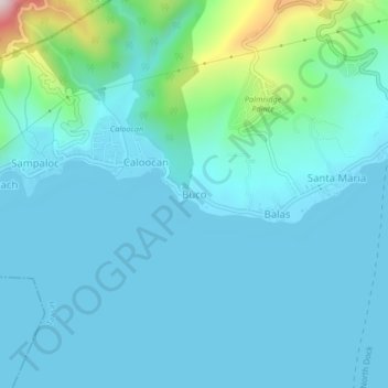
Name: Buco topographic map, elevation, terrain.

Location: Buco, Talisay, Batangas, Calabarzon, 4220, Philippines (14.06447 120.96820 14.10447 121.00820)

Average elevation: 233 ft

Minimum elevation: 10 ft

Maximum elevation: 1,686 ft

Gear up for your next adventure:

🌡️Portable Weather Meter - Track weather conditions on the trail
Backpacking Tent - Lightweight and durable tent for multi‑day hikes
🛶Inflatable Kayak - Portable kayak for rivers, lakes, and expeditions
👟Men's Trail Runners - Lightweight footwear for fast-paced exploration and light hiking
🖼️Topo Map Wall Art - Decorative topographic prints of famous peaks and regions

As an Amazon Associate, this site earns from qualifying purchases at no extra cost to you.