
Make a donation
Gear up for your next adventure:
As an Amazon Associate, this site earns from qualifying purchases at no extra cost to you.
Worthington topographic map
Click on the map to display elevation.
Make a donation
Gear up for your next adventure:
As an Amazon Associate, this site earns from qualifying purchases at no extra cost to you.
About this map
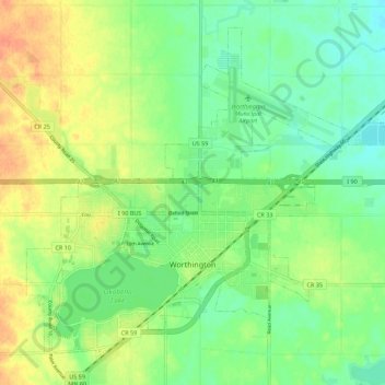
Name: Worthington topographic map, elevation, terrain.
Location: Worthington, Nobles County, Minnesota, 56187, United States (43.60095 -95.64349 43.66983 -95.53271)
Average elevation: 1,591 ft
Minimum elevation: 1,535 ft
Maximum elevation: 1,660 ft
Nobles County trails, hiking, mountain biking, running and outdoor activities
Make a donation
Gear up for your next adventure:
As an Amazon Associate, this site earns from qualifying purchases at no extra cost to you.
Other topographic maps
Click on a map to view its topography, its elevation and its terrain.
Sungold Heights Mobile Home Park
United States > Minnesota > Nobles County > Worthington
Average elevation: 1,581 ft