Geolocate

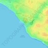
Beaumont topographic map

Click on the map to display elevation.

About this map

Name: Beaumont topographic map, elevation, terrain.

Location: Beaumont, Château-d'Olonne, Les Sables-d'Olonne, Vendée, Pays de la Loire, France métropolitaine, 85180, France (46.48862 -1.73578 46.52862 -1.69578)

Average elevation: 135 ft

Minimum elevation: 36 ft

Maximum elevation: 203 ft

Other topographic maps

Click on a map to view its topography, its elevation and its terrain.
85180

France > Pays de la Loire > Vendée > Les Sables-d'Olonne

Average elevation: 92 ft

85100

France > Pays de la Loire > Vendée > Les Sables-d'Olonne

Average elevation: 16 ft

Gear up for your next adventure:

🔌Solar Panel Charger - Charge gear sustainably outdoors
🏕️Tent Footprint - Protect your tent base from wear
⛺Backpacking Tents - Weight-optimized shelters for multi-day topographic surveys
🪶Compact Camp Shovel - Folding shovel for campsite tasks
🥇GPS Hiking Watch - Multi‑sport GPS watch with navigation and trail tracking

As an Amazon Associate, this site earns from qualifying purchases at no extra cost to you.