Geolocate

Vinning topographic map

Click on the map to display elevation.

About this map

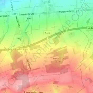
Name: Vinning topographic map, elevation, terrain.

Location: Vinning, Unna, Kreis Unna, North Rhine-Westphalia, Germany (51.50580 7.79100 51.54580 7.83100)

Average elevation: 541 ft

Minimum elevation: 269 ft

Maximum elevation: 801 ft

Gear up for your next adventure:

🪶Camping Sleeping Pad - Comfortable sleeping pad for backpacking
🔌USB Car Charger - Car charger for on‑the‑go power needs
Backpacking Tents - Weight-optimized shelters for multi-day topographic surveys
🎒Hydration Pack - Hands‑free water reservoir for long hikes
🔦LED Headlamp - Bright and durable LED headlamp for night navigation

As an Amazon Associate, this site earns from qualifying purchases at no extra cost to you.