
Make a donation
Gear up for your next adventure:
As an Amazon Associate, this site earns from qualifying purchases at no extra cost to you.
Plan de Guadalupe topographic map
Click on the map to display elevation.
Make a donation
Gear up for your next adventure:
As an Amazon Associate, this site earns from qualifying purchases at no extra cost to you.
About this map
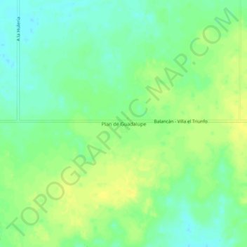
Name: Plan de Guadalupe topographic map, elevation, terrain.
Location: Plan de Guadalupe, Balancán, Tabasco, 86976, México (17.85162 -91.39195 17.89162 -91.35195)
Average elevation: 144 ft
Minimum elevation: 108 ft
Maximum elevation: 174 ft
Make a donation
Gear up for your next adventure:
As an Amazon Associate, this site earns from qualifying purchases at no extra cost to you.
Other topographic maps
Click on a map to view its topography, its elevation and its terrain.
Parque Celia Dolores Abreu
México > Tabasco > Balancán > Balancán de Domínguez
Average elevation: 52 ft
Make a donation
Gear up for your next adventure:
As an Amazon Associate, this site earns from qualifying purchases at no extra cost to you.