Geolocate

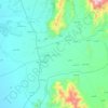
Qataba topographic map

Click on the map to display elevation.

About this map

Name: Qataba topographic map, elevation, terrain.

Location: Qataba, Al Hudaydah Governorate, Yemen (13.85961 43.21595 13.89961 43.25595)

Average elevation: 46 ft

Minimum elevation: 0 ft

Maximum elevation: 118 ft

Other topographic maps

Click on a map to view its topography, its elevation and its terrain.

Hanish

Yemen > Al Hudaydah Governorate

Average elevation: 20 ft

Saba Island

Yemen > Al Hudaydah Governorate

Average elevation: 7 ft

Hays District

Yemen > Al Hudaydah Governorate

Average elevation: 932 ft

Zabid District

Yemen > Al Hudaydah Governorate

Average elevation: 636 ft

Saba Island

Yemen > Al Hudaydah Governorate

Average elevation: 7 ft

Bajil District

Yemen > Al Hudaydah Governorate

Average elevation: 715 ft

Saba Island

Yemen > Al Hudaydah Governorate

Average elevation: 7 ft

Gear up for your next adventure:

🛏️Cold Weather Sleeping Bag - Warm sleeping bag for cold conditions
🏕️Tent Footprint - Protect your tent base from wear
🗻Climbing Gear Basics - Essential gear for beginner climbers
🛰️Handheld GPS Units - Professional satellite navigators for precise backcountry mapping
🧦Hiking Socks - Comfortable socks to prevent blisters on long hikes

As an Amazon Associate, this site earns from qualifying purchases at no extra cost to you.