Geolocate

Itzer topographic map

Click on the map to display elevation.

About this map
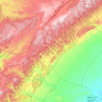
Name: Itzer topographic map, elevation, terrain.

Location: Itzer, Caïdat d'Itzer, Cercle de Midelt, Province de Midelt, Drâa-Tafilalet, 54252, Maroc (32.85099 -5.15764 33.08316 -4.94128)

Average elevation: 6,257 ft

Minimum elevation: 4,669 ft

Maximum elevation: 7,884 ft

Other topographic maps

Click on a map to view its topography, its elevation and its terrain.

Ait-Oufella

Maroc > Drâa-Tafilalet > Cercle de Midelt

Average elevation: 5,771 ft

Aouli

Maroc > Drâa-Tafilalet > Cercle de Midelt

Average elevation: 4,199 ft

Zaida

Maroc > Drâa-Tafilalet > Cercle de Midelt > Zaïda

Average elevation: 4,882 ft

Gear up for your next adventure:

👖Convertible Hiking Pants - Versatile zip-off pants for changing altitudes and temperatures
📻Weather Alert Radios - Stay informed of storm risks while off-the-grid
🌄Hiking Binoculars - Compact binoculars for scenic views and trail spotting
🧷Carabiner Set - Durable clips for gear attachment
🧤Tactile Hiking Gloves - Keep hands warm while operating GPS and smartphone screens

As an Amazon Associate, this site earns from qualifying purchases at no extra cost to you.