
Thank you for supporting this site ❤️
Make a donation
Make a donation
Gear up for your next adventure:
As an Amazon Associate, this site earns from qualifying purchases at no extra cost to you.
Bellbowrie topographic map
Click on the map to display elevation.
Thank you for supporting this site ❤️
Make a donation
Make a donation
Gear up for your next adventure:
As an Amazon Associate, this site earns from qualifying purchases at no extra cost to you.
About this map
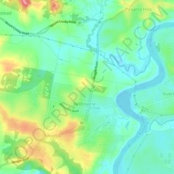
Name: Bellbowrie topographic map, elevation, terrain.
Location: Bellbowrie, Brisbane City, Queensland, 4070, Australia (-27.56860 152.86025 -27.54744 152.90658)
Average elevation: 102 ft
Minimum elevation: 7 ft
Maximum elevation: 292 ft
Thank you for supporting this site ❤️
Make a donation
Make a donation
Gear up for your next adventure:
As an Amazon Associate, this site earns from qualifying purchases at no extra cost to you.