
Quenemo topographic map
Click on the map to display elevation.
About this map
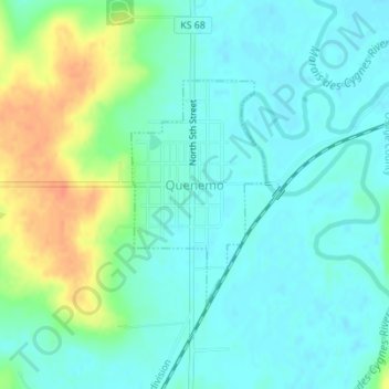
Name: Quenemo topographic map, elevation, terrain.
Location: Quenemo, Osage County, Kansas, United States (38.57109 -95.53258 38.58692 -95.52045)
Average elevation: 968 ft
Minimum elevation: 925 ft
Maximum elevation: 1,066 ft
Osage County trails, hiking, mountain biking, running and outdoor activities
Other topographic maps
Click on a map to view its topography, its elevation and its terrain.