Geolocate

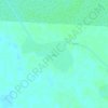
Periet topographic map

Click on the map to display elevation.

About this map

Name: Periet topographic map, elevation, terrain.

Location: Periet, Agnuak, Gambela Region, Ethiopia (7.68777 34.04327 7.72777 34.08327)

Average elevation: 1,411 ft

Minimum elevation: 1,394 ft

Maximum elevation: 1,421 ft

Other topographic maps

Click on a map to view its topography, its elevation and its terrain.
Gambela National Park

Ethiopia > Gambela Region

Average elevation: 1,424 ft

Moun

Ethiopia > Gambela Region

Average elevation: 1,325 ft

Gear up for your next adventure:

🧺Microfiber Travel Towels - Compact and fast-drying towels for trail use
📷Action Cameras - Rugged cameras to document your journeys across rugged terrain
🛶Inflatable Kayak - Portable kayak for rivers, lakes, and expeditions
🛏️Cold Weather Sleeping Bag - Warm sleeping bag for cold conditions
🌡️Portable Weather Meter - Track weather conditions on the trail

As an Amazon Associate, this site earns from qualifying purchases at no extra cost to you.