Geolocate

Crockenhill topographic map

Click on the map to display elevation.

About this map
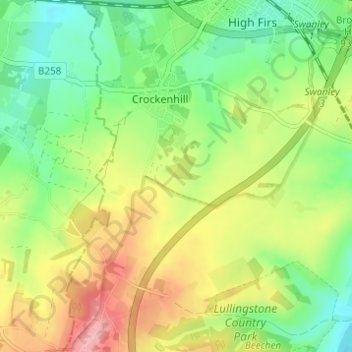
Name: Crockenhill topographic map, elevation, terrain.

Location: Crockenhill, Sevenoaks, Kent, England, United Kingdom (51.35448 0.14519 51.39280 0.19052)

Average elevation: 315 ft

Minimum elevation: 154 ft

Maximum elevation: 548 ft

Gear up for your next adventure:

📖Nature Tracking Books - Learn to track wildlife and terrain
🧭Compass with Lanyard - Easy‑carry compass for navigation
📦Gear Storage Bags - Organize and protect outdoor equipment
📡GPS Antenna Upgrade - Enhance GPS reception in remote terrain
📱Heavy-Duty Phone Cases - Drop-proof and waterproof protection for outdoor navigation

As an Amazon Associate, this site earns from qualifying purchases at no extra cost to you.