Geolocate

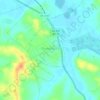
Browder topographic map

Click on the map to display elevation.

About this map

Name: Browder topographic map, elevation, terrain.

Location: Browder, Muhlenberg County, Kentucky, 42337, United States (37.17726 -87.05638 37.21726 -87.01638)

Average elevation: 463 ft

Minimum elevation: 397 ft

Maximum elevation: 584 ft

Muhlenberg County trails, hiking, mountain biking, running and outdoor activities

Other topographic maps

Click on a map to view its topography, its elevation and its terrain.
Drakesboro

United States > Kentucky > Muhlenberg County

Average elevation: 430 ft

Central City

United States > Kentucky > Muhlenberg County

Average elevation: 449 ft

Greenville

United States > Kentucky > Muhlenberg County

Average elevation: 489 ft

Gear up for your next adventure:

🏔️Mountain Trail Maps - High‑detail maps for popular peaks
🗃️Trail First Aid Kit - Essential kit for outdoor injuries and emergencies
🔥Plasma Lighters - Windproof lighters that work in any weather condition
🧤Tactile Hiking Gloves - Keep hands warm while operating GPS and smartphone screens
🔊Portable Camp Speaker - Music and alerts at camp

As an Amazon Associate, this site earns from qualifying purchases at no extra cost to you.