Alfdorf topographic map
Click on the map to display elevation.
Alfdorf
The municipality (Gemeinde) of Alfdorf lies at the easternmost extremity of the Rems-Murr district, along its border with the Ostalb district. Alfdorf is physically located in the Schurwald and Welzheim Forest, regions of the larger Swabian-Franconian Forest. Elevation above sea level in the municipal area ranges from a high of 566 meters (1,857 ft) Normalnull (NN) to a low of 307 meters (1,007 ft) NN.
About this map
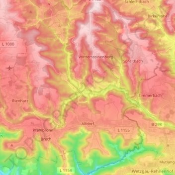
Name: Alfdorf topographic map, elevation, terrain.
Location: Alfdorf, Rems-Murr-Kreis, Baden-Württemberg, 73553, Germany (48.81434 9.63179 48.91513 9.76941)
Average elevation: 1,562 ft
Minimum elevation: 991 ft
Maximum elevation: 1,886 ft
Other topographic maps
Click on a map to view its topography, its elevation and its terrain.